The Beginning
At some point in January I became extremely bored and started looking at short three to four day backpacks I could fit in between now and the end of summer. I looked at the Sunol/Ohlone Wilderness area, the Lost Coast, and the Skyline-to-Sea Trail. After brainstorming various scenarios I settled on the Skyline-to-Sea.
The trail had come up before in discussions I have had with other Scouters but other than an article I read in Boys Life (Boys Life August 2010) I hadn't run into anyone who had actually hiked it. A first it was a hike I planned on doing by myself -- three days in the redwoods without any distractions sounded really good right about then. Of course, that was before I found out about the very cool patch that could be earned through Monterey Historic Trails. Those that know me well know that I will do just about anything for a patch (in fact I have collected a polar bear patch from every summer camp I have attended) so I made a few calls and had a group of six scouts put together in just a few days.
In the month leading up to the trip the number of hikers changed a few times then settled at nine two weeks before we left. We spent that time experimenting with different recipes and developing our own freeze-dried meals. My son Gavin came up with a muffin called Mt. Fuji Rice Cakes. He used the recipe in the book The Scouts Backpacking Cookbook, by Tim and Christine Conners, and, though a tad on the heavy side, everyone gorged themselves on this breakfast treat. I would recommend these for any backpacking trip.
With nine of us going we split grub duties between four different cooks. Three of the scouts were working on their Cooking merit badge. I was the fourth cook just because I was a little rusty at cooking group backpacking meals and wanted to try something different. Trail breakfasts are rather easy -- typically it is nothing more than a type of dried oatmeal or pre-cooked nutrition bars like Gavin's Mt. Fuji Rice Cakes. Lunches are the same: hard salami or sausage; cheese; hard crackers; jerky; and gorp. But dinners are special. It is the end of the day, and after a long day of hiking you deserve a good tasting, nutritious and hot meal.
There are a meg-zillion (technical scout term for 'lots') websites that have various ideas on cooking trail meals. There are any number of books that will give step-by-step instructions on preparing and dehydrating different types of food. But the one website I kept coming back to was www.dirtygourmet.com. For those that know me this will seem incredibly out of character since this website is mostly vegetarian, and I am a card-carrying carnivore. As weird as it sounds, the recipes on the website actually made my mouth water, and none of them were very difficult to make on the trail. So I took what I considered to be my favorite recipe and made a few, let's say, adaptations to it...
I took their main recipe for the "Not Your Average Ramen", ditched the dehydrated corn (I am not much of a corn fan) and added dehydrated mushrooms and dried edamame beans (I just happened to find a bag of these at a local supermarket shelf and grabbed them for later use). I put everything into quart size freezer zip-lock bags and tossed in a packet of soy sauce, butter flavoring and chili sauce. I also picked up a can of pineapple chunks and a can of hickory smoked spam. Wow, did this really tick off the scouts when they realized they had been carrying cans of food for three days, but there was no way to really make the stuff last that long without cans...
I made dinner the last night in camp -- I boiled water for everyone to add to their bag of tricks, then I fried up the pineapple chunks and spam and added this to the mix. I even carried in a little Nori Rice Seasoning and packaged pink salmon. For all the complaining about the cans they sure ate everything up! But that could have been because they didn't want to carry anything out the last day :o)
Day 1
First I want to say thank you to my loving and patient wife. She took the time out of her day to drive us two and a half hours one way just to drop off us at a parking lot in the middle of nowhere. We started from the Saratoga Gap parking lot, more of a mini rest stop than parking lot, at the intersection of Highways 9 and 35 in the Santa Cruz Mountains. This isn't even the actual trail-head, just the nearest spot to drop off hikers. We walked 25 yards down Highway 9 before coming to the start of the Skyline-to-Sea-Trail.

Back: Marcus and me. Front: Emily Malcolm, Nick, Brian and Gavin. Jamie Robb, Logan and Sam would meet up with us the next day. Logan was going up before a Eagle Board of Review this evening.
Right from the get go we knew we were on a unique trail. Most of the hiking we do is in the Sierra Nevadas or going up various mountain peaks. We are used to wide open spaces with lots of sun and pockets of shade. This trail descended immediately into a dense forest of tan oaks and nothing but shade. We were also a lot lower than we normally hike. We started hiking at 2600 feet and descended from there. Our typical hikes in the Sierras take us over 5000 feet on a regular basis. Though the Skyline-to-Sea is no cakewalk, it was a nice change of pace and we enjoyed the thick forest we hiked through.


Marcus next to the information sign at the trail-head.
During our research we read several accounts of previous hikers suggesting that you start the hike in Castle Rock State Park and take the Saratoga Gap Trail to the Castle Rock Trail or Frog Flat Camps, then cut across and meet up with the Skyline-to-Sea further along Highway 9. Though this does have its benefits since you will head into the park interior and away from the highways, we decided as a group that we were going to hike the entire trail from start to finish.

An interesting sight.

On the trail.
The trail descends along a ridge in a very dense tan oak forest and then climbs from time to time as you criss-cross the highway several times. One benefit of following the highway was that we came across several geocaches along the way and we found three on our first day. Though we did not have very far to go that day we took our time, looked for the the geocaches, and adjusted our packs as we went. The weather was comfortable, in the mid-80s, and the trail was much softer than we were used to.

Nick finds a geocache.

Me and Gavin.

Marcus takes a break.

Crossing the highway...again.

Lunch time!

Nick finds another geocache.

Back on the trail.

Still truckin'...

Me taking a picture of Nick, Gavin and Marcus, with Emily taking a picture of me.

And from the other side...

Water break!

Are we there yet?

Waterman Gap Camp.
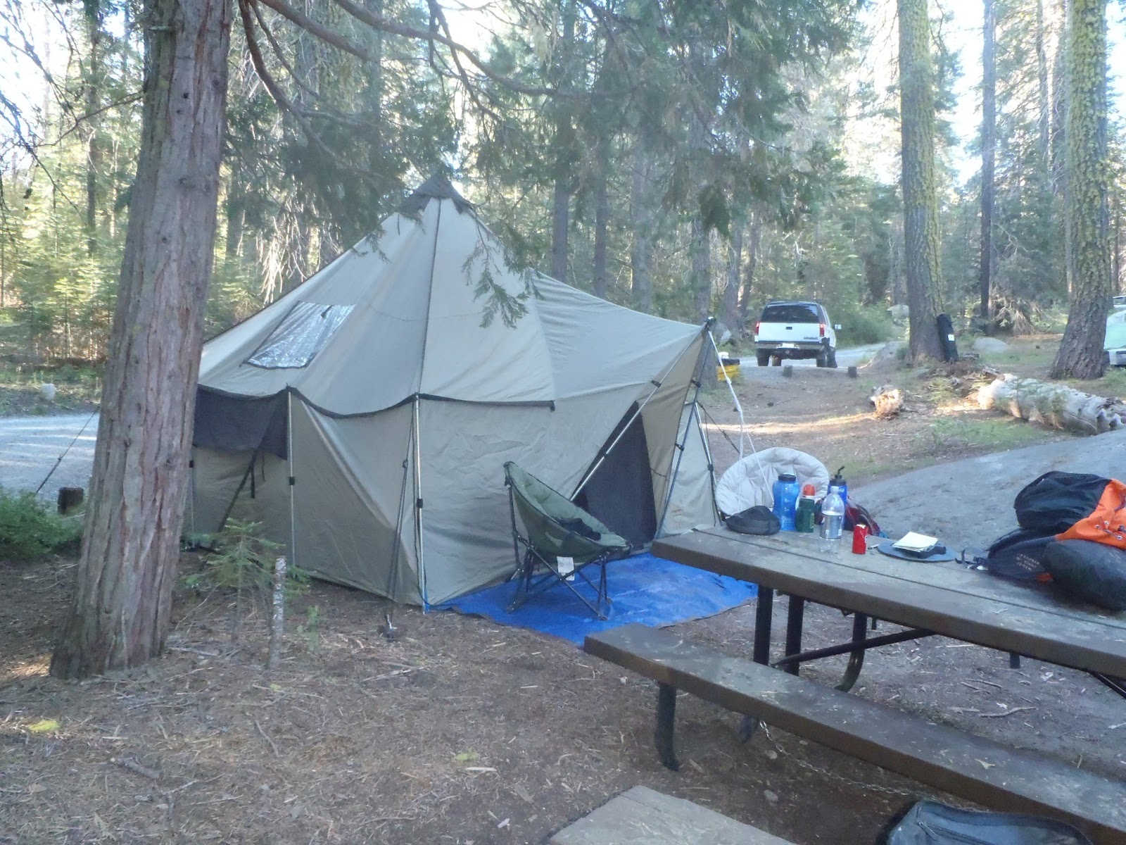
We reached Waterman Gap Camp a little after five and quickly made camp. I had no trouble finding a place to hang my hammock. Nick made a hammock out of some rope and his tarp. Everyone else spread out their tarps on the ground and laid out their bed rolls. I am proud to say that of the hikers we ran into on the trail and in the back-country camps, we were the only group that did not use tents. Now I know some of you are thinking that we are plain nuts and what if this and what if that. Personally, I am proud of everyone for being comfortable enough to sleep out under the stars, and second, we have been on enough back-country trips that if we did run into rain or other issues each one of us carries a tarp and we could (and on the last night did) make shelters that would keep each of us warm and dry.
Marcus was our cook for that night and he made a Cowboy Stew that really hit the spot. We discovered a banana slug in our cooking area that seemed to follow Emily wherever she went. In the morning the slug was gone and the running joke was that it had curled up in Emily's pack. I think she was more afraid that one of us had put it in her pack than the slug actually crawling in on its own :-)

Marcus makes Cowboy Stew.

The infamous banana slug...we never did discover where it went to.
After dinner I stayed up a while with a few of the guys and we played cards. I felt myself drifting a little after eight and called it a night. The guys didn't last much longer and just after 8:30 everyone was zonked out.

Bedtime!
Day 2
I was up a little before six and felt absolutely great! The birds were singing, the sun was rising and it looked to be a beautiful day. Everyone was up within the next half hour and Marcus got our breakfast, a protein-filled oatmeal, ready to go. This was going to be our big day -- we had a 800 foot ascent ahead of us before we began hiking down into Big Basin State Park. Our mileage for the day was going to be a tad over 12 miles. Everyone knew that the roughest part would be in the morning, then we could relax once we hit the summit and headed back down.

Emily with her small cup of coffee...
A quick note about reading other blogs for trail research. To be honest, hikers are a lot like mothers when it comes to first time birth -- they lie thru their teeth. Whenever a hiker describes an ascent as "after a slight ascent to the top of the ridge" they really mean "after sucking wind for the last mile and pulling yourself up hand over hand over the last switchback the view in front of you will slowly come into focus as you fight to get your breathing back under control..." Not that the uphill parts were all that bad, but please, don't trust what you read in hiking blogs regarding any mention of "ascents."

Going up...

Still going up...

Nick and Gavin on a water break.

Marcus finds a new friend. This friendly cat belonged to a house we passed by. The cat must be used to hikers because when it saw us it came down the driveway to play...

The link up...Back: Jamie Robb. Middle: Nick, Brain, me, Logan. Front: Marcus, Emily, Sam and Gavin. Logan had his Eagle Board of Review the night before and drove up that morning to join us on the trail. This is his first official day as an Eagle Scout. Don Nevis took the time to drive them down and meet us at one of the many road crossings.
With that said, while we did climb over 800 feet that morning, the steep uphill sections really weren't that bad. It was a gradual climb over 4-5 miles, and the really steep sections were so short and far apart that we had forgotten all about the last one when we started up the next one. That said, we all collapsed in a heap at the top of the summit on China Grade Road and sucked down water, jerky and gorp while we caught our breath.

Almost to the top...

The top, China Grade Road. The trail continues directly across the road. We found out later that there was a Boy Scout Camp at the end of the road.

Lunch time!
I would say that the rest of the hike was rather easy, but now that we were up on the summit there was lots of sun, more sun than we had seen the day before. We already missed the dark coolness of the redwood forest we knew waited below us. We stopped at one open area that was all rock and looked for a geocache but was unable to find it. As we moved deeper into the basin the sky disappeared and we found ourselves back among the redwoods. As soon as we hit the floor of the basin you could feel an unspoken urgency within the group. It had been a very long day and we were only a few miles away from the headquarters of the park. We were all aware of the general store there and I think we were all anxious just to get the days hike over and grab a cold drink or two

Nick looks for a geocache.

Going...down.

A welcome sight!

The newly minted Eagle Scout with Jamie and Sam.
We arrived at the store just after five. We were tired, sweaty, and I do believe we scared a few day trippers as we tossed our packs on a picnic table and invaded the store. This may have only been our second day on the trail but we acted a little mad as we devoured hot dogs, ice cream and popcorn.

The general store.

My light snack before dinner...

A well deserved rest stop.

We arrive at Jay Camp.

Marcus and Sam make dinner.

Marcus and Sam getting ready for bed.
After spending a small fortune we pulled our packs back on and finished the last quarter mile to Jay Camp. I was asleep shortly after getting my hammock up.

Day 3
We got an early start and made our way back to the store to supplement our trail breakfast. This morning we started with Gavin's Mt. Fuji Rice Cakes and supplemented that with hot coffee, hot chocolate, and fresh fruit from the general store. I managed to drop by the park store and picked up a locally made Dream Catcher for my wife and kept up with our family tradition by picking up a park magnet. This tradition was started by my older son many years before and now we manage to pick up a magnet at every park we visit. Before we headed out we decided to take the Redwood Loop Trail and pay our respects to the Mother and the Father of the Forest. These are two very large redwoods and as I told the scouts, why bother coming all this way if you are going to miss the main attraction of the park? We also stopped by the Chimney Tree and took in some local lore that the trail guide provided.

Breakfast time. Emily is still searching for the lost banana slug...

The Chimny Tree. From left: Nick, me, Marcus, Sam, Logan, Brian and Jamie.

The Father of the Forest.


Nick and Marcus at the Father of the Forest.

Marcus at the Mother of the Forest.
By 11 am we were on the trail and making our way up the last (or at least we thought it was the last) of our ascents. Most of the trail guides I had read had mentioned this was a short uphill and they were right. We stopped at the top of the ridge and enjoyed a quick snack while Nick and Marcus went off to find another geocache.

The end in sight - Waddell Beach.

The top of the ridge: Middle Ridge Road.
A short note for those of you who think hiking is a game instead of a reality check. While we were snacking a young couple wearing thin flip flops and with one water bottle between them strolled by and asked which way to Berry Creek Falls. Without a word I motioned to the trail sign that warned all hikers that it was a very strenuous three miles to the falls and all hikers should be prepared. They bopped down the trail without a care in the world. Part of me suspected I would see them again, and not in such a good mood.

Nick and Marcus came back with word that they had found the geocache and we pulled our packs back on for the descent to Berry Creek Falls. It was during the hike to Berry Creek Falls that I really took the time to look around. True, it could have been the blister that was forming underneath by left big toe slowing me down, but by that time I was in a rhythm, and even that didn't slow when I felt the blister pop and a rush of relief overwhelmed me for an entire second before the raw flesh met the coarseness of my hiking sock. Even then my gait didn't slow and I padded along for the three miles to the Falls before I took off my boot and repaired the damage.
Ever since I was a young pup the redwoods have held a special fascination for me. Growing up my parents would take us on a two week vacation to Jedediah Smith Redwoods State Park (http://www.parks.ca.gov/?page_id=413) and Prairie Creek Redwoods State Park (http://www.parks.ca.gov/?page_id=415). I always felt comfortable in the redwood forests and enjoyed my time there every summer. Now, for the first time during this trip, I felt the same easiness overcome me and I relaxed as we hiked the last few miles to the Falls. And just as I predicted back on top of the ridge, we passed the young couple as they were trudging back up the trail: she with a look of pure hatred on her face and he trying to make light-hearted jokes as he slipped and slide in his flip flops. I almost felt bad for what the young fellow would face once she got back to solid ground.
When we reached the Falls we all collapsed in a heap and took our boots off to survey the damage. Almost all of us had at least one blister if not a few hot spots. I slipped out of my boots, placed some more mole skin on two newly forming blisters and some second skin on the one that had popped and pulled on a fresh pair of dry socks. The housekeeping chores done I settled down with my back to a log and snacked on gorp, hard salami and cheese. Nick and Marcus gathered up our empty water bottles and climbed down to the creek to filter water. I am not sure how long we stayed at the Falls but it was growing late in the day as we saddled up to finish the last four miles to our next and last camp.

Jamie relaxing at Berry Creek Falls.

Me, Nick and Logan chilling out at the Falls.
A few hundred yards from the Falls the trail widened into a fire road. We would stay on this until we reached our destination. At some point on the road we felt that ocean breeze which carried the smell of salt air. We all perked up at that and I think we all picked up the pace. We passed a couple on horseback and began to pass older folks out for their evening stroll. It wasn't until we passed a couple with young kids that we knew we weren't too far away from the end of the trail. And then, almost as an after thought, we were there. I almost walked right by the camp until Emily caught my attention. The sign was facing away from us so I missed it completely. But there we were, Twin Redwoods Camp. My back, and feet, and never felt so relieved.
We picked out our campsites and set toward making camp. I found two trees to hang my hammock and was set up in a matter of minutes. I slipped out of my boots and into my camp shoes and hustled over to our kitchen area to make dinner. When I asked for the cans of spam and pineapple the boys nearly stoned me to death with them. I guess I can't blame them, they had been carrying them since the beginning. I dug into the bear canister and brought out the individual baggies I had prepared for everyone before we left home. Nick and Marcus went down to the creek for water and I readied our three camp stoves. Once I had the water boiling I added a cup to each packet and let the ramen soak while I fried up the spam and pineapple.
With the extra nori seasoning, thai chili sauce and packaged pink salmon I had packed the dinner turned out better than I expected. Either they really enjoyed the hot meal or because the boys decided they weren't going to carry any more than they had to on the last day, the food simply disappeared. We cleaned up dinner and the scouts reorganized their bed roles. A steady breeze had picked up and was starting to whip through the campsite. Brain and Logan made a A-Frame tent out of their tarps and huddled down in their sleeping bags. Marcus and Sam made a lean-to with their tarp and were quite comfortable all night. Nick just buried himself under his gear and slept soundly all night. I stayed up until almost 8:30 playing cards with Nick then climbed into my hammock. Emily was already wrapped up like a cocoon and Jamie climbed into his bivy. We had all packed light for this trip but right then we were hoping that we hadn't gone too light. As it turned out the breeze drifted away and we actually became a little too warm during the night.
Day 4
I'm not sure what woke me but I was wide awake by 5:30 and watching the sky lighten from the comfort of my hammock. I quietly climbed out of my hammock and slipped into my camp shoes. I went over to the boys campsite and checked on everyone. Brain was already up, though still tucked comfortably in his sleeping bag. Marcus woke up when he heard me but except for his eyes he didn't move a muscle. I went down to the creek for water to boil for breakfast.
Everyone was up by seven and we broke camp by eight. There really was no hurry. We were less than two miles from the end. Our ride wasn't scheduled to be there until sometime between 10 and 12. We had plenty of time. I think it might have been the change in the air. There is something about camping near the ocean that changes the air around you. Even though we were still two miles a way I could swear that I could hear the waves. Whatever it was it affected all of us.
Less than a hundred yards from the camp we came across a fork in the trail. A sign directed all hikers one way and all equestrian and bikes another. Some trip report I had read mentioned that it really didn't matter which way you went, and the majority seemed to follow the road. Since we decided early on that we were going to take the trail from the beginning to the end we followed the sign...and found ourselves climbing another bloody ridge.
It was not a bad climb as climbs go. We had certainly traveled over worse in the Sierras. It was just that it was unexpected. We had figured that the climbing was behind us. We were nearly at sea level and we had come down the last ridge between us and the deep blue sea. The very last thing we thought we would be doing was climbing over three hundred feet. But there it was, larger than life, a trail that sloped upwards. As our legs carried us upwards our morale dropped downwards...until Nick picked us up again with a game he had learned at the Emerald Bay Boy Scout Camp on Catalina Island.
The purpose of the game was to name off a series of numbers in order before another of your party could say it. Nick would start off with one then someone would shout out two, three etc. You think it would be an easy game, just each person in line shouts out their number. Oh no, it became a competition to see which person could shout out "two" before anyone else. I think the highest we got was "five" since Emily, Marcus and myself were determined to be the ones to shout out "two." Well, it might seem like a stupid childish game but it got our minds off the climb and our aching feet. Thanks Nick.

Going...up? Marcus, Logan, Jamie, Sam and Brian on the trail.
Once on the ridge the trail seemed to meander everywhere. One second we would have a glimpse of the road far below, the next we would be in a thick stand of trees and not be able to see anything but the rock face to our right. For what was supposed to be an easy couple of miles was starting to feel like much more. Just when we were reaching our lowest and I was ready to call a break, well, just because, we rounded a bend and there it was, laid out below us in perfect postcard detail was Waddell Beach and the Pacific Ocean. All the pain and frustration went away at that moment as we gazed upon the destination we had spent the last three days working towards.

Nick and I soak in the beauty...
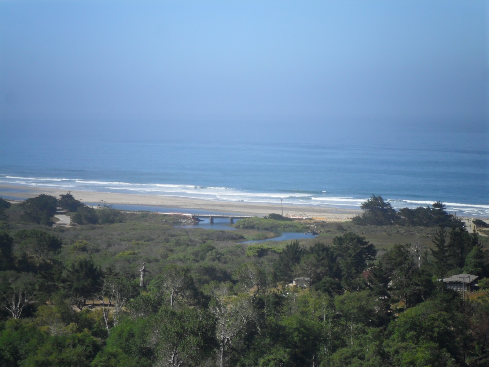
The view: Waddell Beach and the Pacific Ocean.
This wasn't a difficult trail, but it had a personality all of its own. I had read blogs of people who had done the entire thing in less than two days, and even one account of a woman that had done it in a day. My question to them is why? This was our fourth day and we reached the end that morning. Part of me wanted to turn around and do it again. For me I think it was the journey from the top of the mountain and making our way down to the sea. The change in elevation, the change in scenery and the change in the environment around us could only be viewed by walking down this trail. Not something I would want to rush through.
With the end in sight we made quick time down the rest of the trail. I didn't even notice when the trail started to slope downward. We stopped for a few minutes to look for a geocache but our hearts really weren't into it and we continued along the trail. Before we knew it we were at the end. I ducked down to avoid a branch, took two steps and found myself on pavement. I was at the end of the line.

At the end: Brian, me, Nick, Logan, Jamie, Marcus, Emily and Sam.
For a few moments we all stood there deaf mute, it hadn't kicked in yet that we were done. All that was left was to hike down the road to the beach and wait for our rides. But that hadn't settled in our heads yet. We were still in hiking mode: one foot after the other. A group of bikers rode by and one fellow, who must have recognized the look on our faces, stopped long enough to chat and take our picture. He asked if we had started up at Saratoga Gap and when he got a positive response he was the first to congratulate us on completing the trail.

Nick really believed that there was a higher power trying to keep him from completing the trip...A quick note about Scouts: you can tell that a Scout is active by the color of his uniform -- if you notice Nick's hat -- it was a dark green color when he first bought it. Now it has faded to an almost tannish-brown color.
That woke us from our dream. We dropped packs long enough to use the bathroom and headed down the road to finish our four-day hike: it was Waddell Beach or bust. It was a change from walking on dirt to pavement, and it didn't help our feet at all. But we put one foot in front of the other and before we knew it we were ready to cross one last highway: Highway 1. We made it across without incident, posed just long enough for a group photo and made a dash for the blue cold water of the Pacific.

The end end of the line -- Waddell Beach: From left: Jamie, Brian, Logan, me, Nick, Sam and Marcus.
As soon as I hit the sand I was out of my pack, out of my boots and stripping off my pant legs. For the last four days I had been thinking about this very moment. It was time to get my feet wet. If I told you how I imagined it then just picture that famous scene from Chariots of Fire with all the guys running along the beach and the catchy soundtrack in the background. In reality it was more of "uh, ah" hobble along the hot sand with our battered feet until we were ankle deep in water then managing to hold ourselves still long enough for the sting of the saltwater on our open wounds to fade away.

Brian and Logan reach the beach. Marcus is in the background kissing the sand.

Marcus and Logan strike a pose.

The water was cold! But very refreshing.

Nick goes body surfing.
Whichever vision you want to go with we did strip down and we did get wet and then we collapsed on the warm sand and snoozed until our ride showed up for the final leg back to Sacramento.

Jamie and Logan chilling on the beach...
I want to really thank my wonderful wife Ami and my good friend and Crew 136 Committee Chair Don Nevis for taking the time out of their busy schedules to provide transportation so we could go on this crazy hike so far from Sacramento. Without their dedication and support trips like this would be much more difficult to organize. They took the time to drive four and a half hours round trip to drop us off and pick us up in the middle of nowhere. To make communications worse, after we descended into the basin there was no cell coverage, so there was no way to communicate between us and our rides home. Ami and Don, thank you so much!
I also want to thank Bill Heberger, the current Scoutmaster of Troop 136, for putting up with my wild, sometimes spur of the moment ideas. Without his help and support I wouldn't have been able to pull this trip off, let alone the next one!
Emily and Jamie: Thanks!!! You are both great hiking partners and thanks for a wonderful trip! Emily, thanks for always listening to my crazy off-the-wall ideas. If it wasn't for your gung-ho attitude I think most of the ideas would fall flat and die a quiet death. Jamie, thanks for saying yes before you knew what you were getting into! I couldn't think of a better pair to be on the trail with.
A thanks goes to Ron Williams of Monterey Historic Trails. Thanks for responding so quickly to my inquiry about the trail and the available patches. We are already showing them off at every scout event we attend! And thanks for the information on the Montery Historic Trail! We are looking into completing that within the next year.
For more information about the trail and how to obtain the Skyline-To-Sea Trail Patch you can write Ron Williams at Monterey Historic Trails, 644 Lynson Street, Monterey, CA 93940.

Resources:
RedwoodHikes.com
BSA Troop 362: Skyline to Sea
Skyline_to_the_Sea_Trail_Camp_Information.pdf
http://kevingong.com/
http://www.bigbasin.org/
http://trails.sierraclub.org/